Real-time road and public transport commuter information
![]()
Symbiote uses design, data and technology to improve people's days; and has leveraged Transport Victoria's Open Data datasets across two key digital services: VicTraffic and Public Transport Victoria's (PTV) Journey Planner.
Datasets Used
VicTraffic
• Vicmap Transport - Road Line
• Unplanned Disruptions API
• Planned Disruptions API
PTV
• PTV Timetable APIs
• Product Feature - Stop Departures, Service View
• Product Feature - Stop Departures, Service View
• Patterns
• Product Feature - Service View
• Stops
• Product Feature - Route Overview, Timetable View, Disruptions
• Product Feature - Route Overview, Disruptions
• Routes
• Product Feature - Disruptions
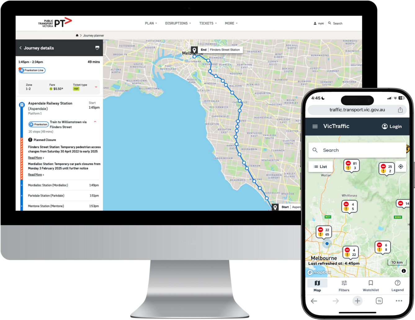
VicTraffic’s new digital disruption mapping system gives all road users an easy and reliable way to stay updated about road closures. Symbiote identified and integrated 19 data sources including open data enabling road users to plan journeys and receive immediate notifications about traffic disruptions – every day or during emergencies – displaying routes within Victoria and into its neighbouring states.
VicTraffic brings open data to life through:
• use of a Progressive Web App, an application built using web technologies but provides a user experience similar to a native mobile app and a uniform experience across multiple devices, whilst reducing maintenance and cost
• user accounts and watchlists allowing users to create an account, personalise what they see, watch area(s) relevant to them and monitor a disruption directly
• personalised, real‑time alerts via push notifications.
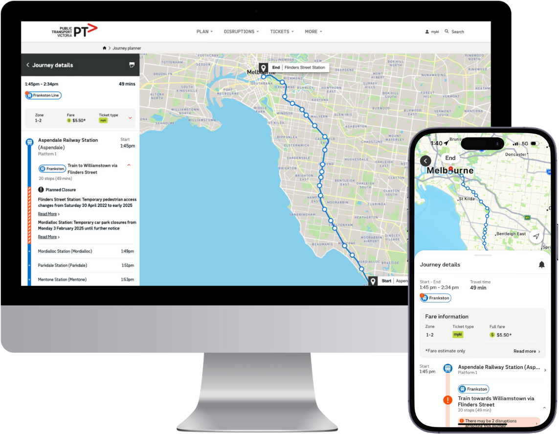
PTV’s journey planner gives Victorians a range of ways to plan or adapt their public transport journeys.
Symbiote developed middleware for PTV that integrates information from open datasets for timetables, stop departures, services, routes and disruptions. They also developed a user-friendly website and mobile apps that present the integrated data so people who use public transport can personalise and filter information to see all their travel options. For example, they can choose their preferred types of public transport or routes, see accessible stops and platforms, or display trips that minimise the amount of walking they need to do.