How CrowdLab has built an Interactive Crash Map at a National Scale for Local Insights
CrashDash by CrowdLab
![]()
Overview
Road crash data is publicly available across Australia, but turning it into usable analysis is slow and technically demanding. Council transport teams and road safety officers typically spend hours extracting, cleaning, and presenting data before they can begin work. For teams preparing funding bids, network assessments, or Black Spot submissions, that friction has a real cost.
Approach
CrowdLab built CrashDash to sit on top of official police-reported crash datasets from seven Australian states and territories, making that data explorable directly on a map. The platform ingests and normalises state data so users do not need to handle raw files. Analysis tools, filters, and exports are purpose-built for how council practitioners actually work.
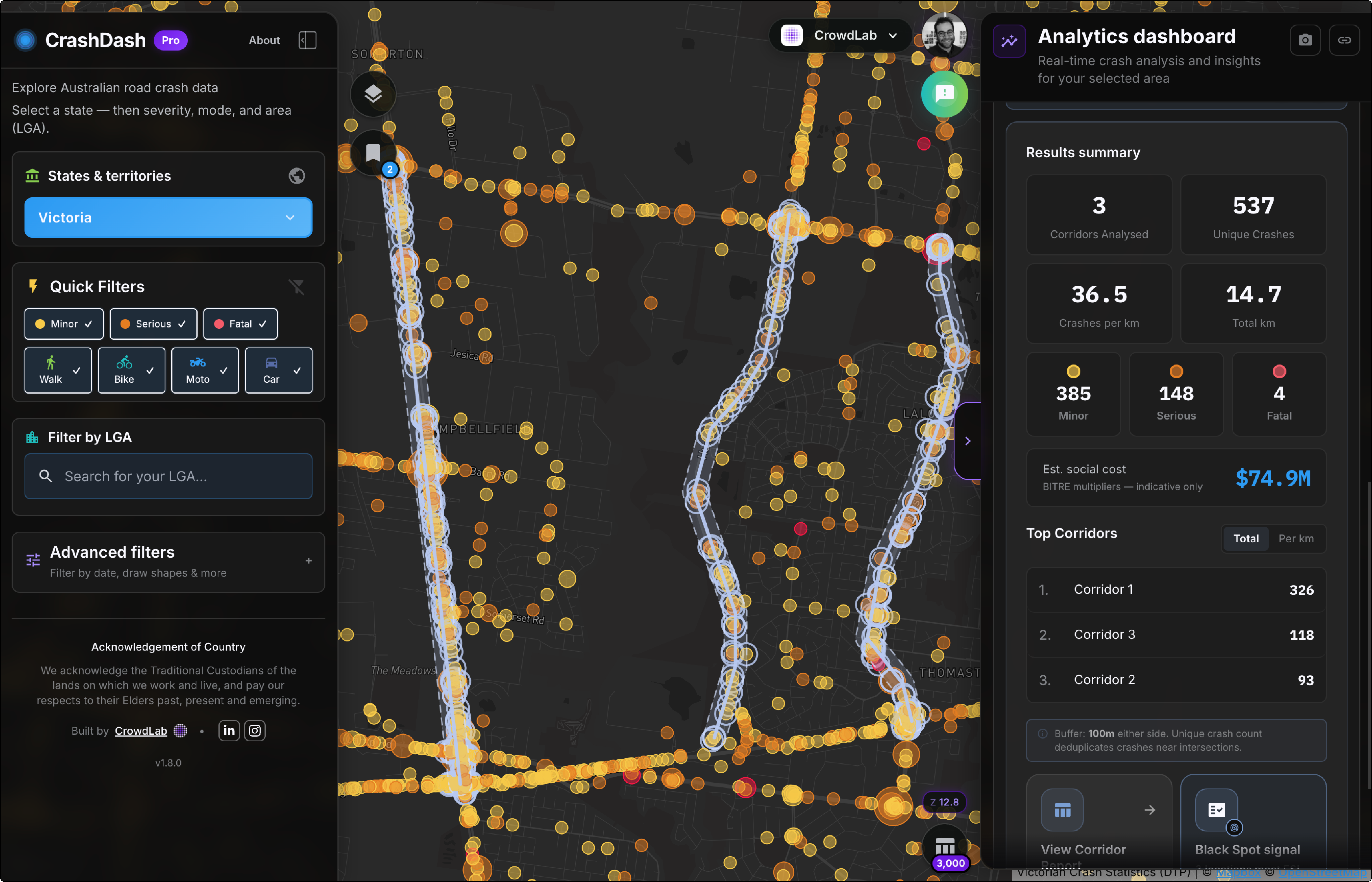
Solution/Outcome
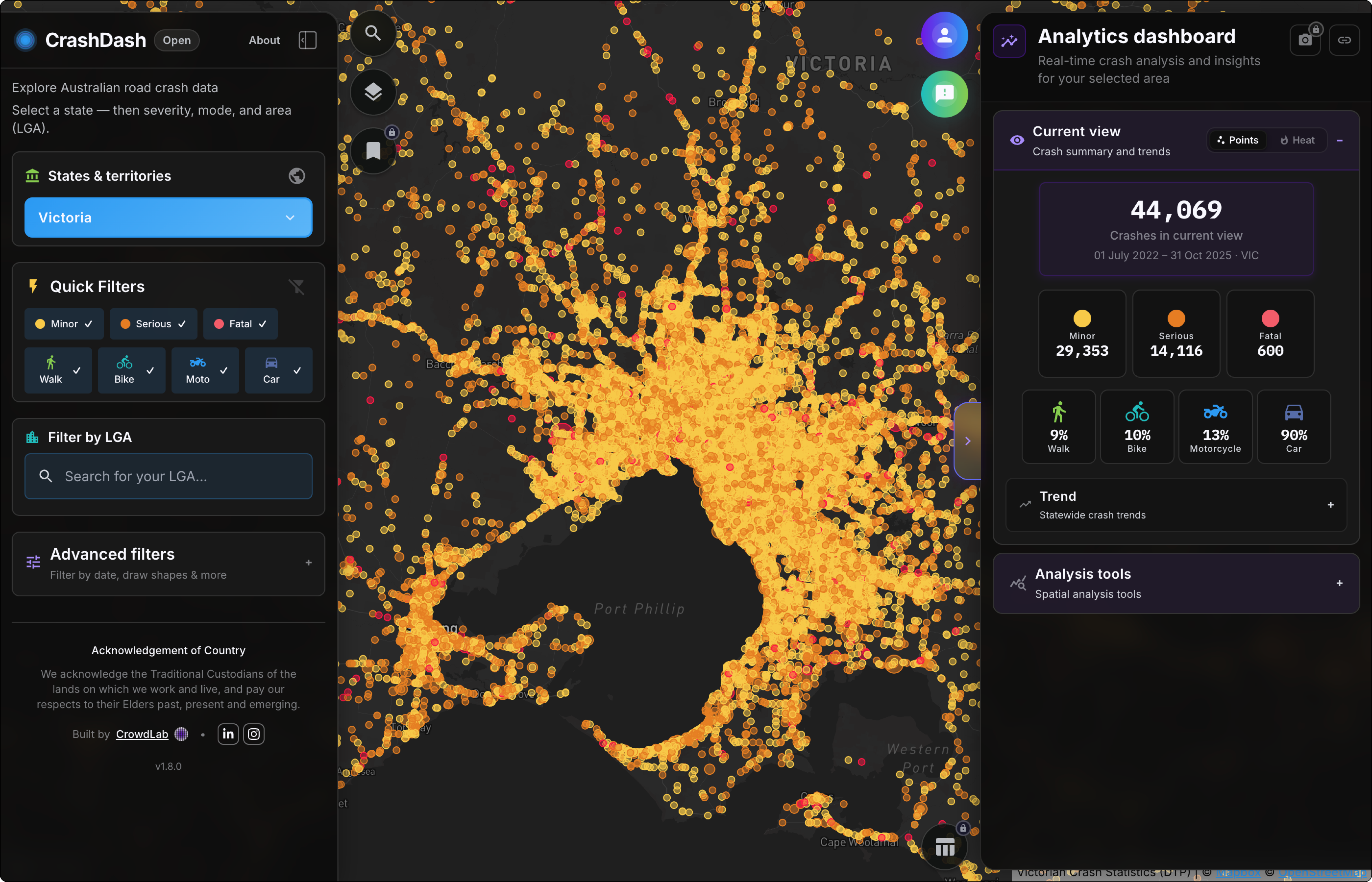
CrashDash is free to browse and explore the national crash map, filter by crash type, severity, road user, time of day, and speed limit. Creating a free account unlocks saved views and notifications when new data becomes available. A professional tier, developed in close collaboration with councils across Australia, gives transport teams and road safety officers deeper analysis tools including proximity analysis, corridor analysis, and exports for reports and funding submissions.
Datasets used
- Speed Zones
- Victoria Road Crash data
- Bicycle Infrastructure Network